Applegarth, Richmond, Coast to Coast
More Articles in the Reeth to Richmond subsection
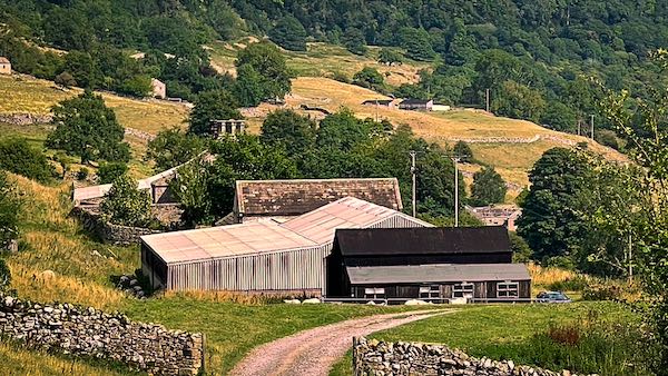
Approaching West Applegarth on the Coast to Coast path
Applegarth, Swaledale, Richmond, Coast to Coast
Applegarth is an ancient settlement of North Yorkshire, 2.5 miles east of Richmond, and just less than a mile north east of Marske. The settlement of Applegarth includes (from west to east) Applegarth Scar, Applegarth Low Wood, West Applegarth, High Applegarth, Low Applegarth and East Applegarth. Coast to Coast walkers hike along the Applegarth bridleway past each of these settlements en route to Richmond.
In the past the top of Applegarth Scar, which is now farmland, was wild forest, native to which were fallow deer and wolves. Fallow deer are native to Turkey but were introduced to England during the Roman period. The River Swale flows at the foot of Applegarth Scar.
Applegarth Scar
Applegarth Scar, seen from the south, takes the form of a mesa-like plateau rising above the farmland. The Scar is a mile north east of Marske and overlooks the entire Applegarth Settlement. The River Swale is only 100 yards or so to the Scar's south.
Applegarth Low Wood
Applegarth Low Wood throngs the steep sided north riverbank of the River Swale, filling the gap between the Scar and the River. It comprises a broad mixed swath of deciduous trees, similar to those contained upon the Scar itself, including long leaf lime, cliff yews and W9 type ashwood. On the opposite riverbank are Hag Wood and Kirkgate Wood.
West Applegarth
The first of the farming settlements approached while walking the Coast to Coast path is West Applegarth, which lies just west of Salmon Gill and the fold of land between the twin Scars of Applegarth and Whitcliffe. West Applegarth is positioned below the south east face of Applegarth Scar.
Hag Wood
From the Coast to Coast path at Low Applegarth there is a clear view across the River Swale to Hag Wood and the Swaleview Caravan Park that populates the level ground on the south riverbank.
Salmon Gill
Salmon Gill springs from the col between West Applegarth and High Applegarth. It is a very modest gill, flowing across the route of the Coast to Coast path to trickle through Collier Hag Wood and spill into the River Swale.
Low Applegarth
Low Applegarth is on the south side of the Applegarth bridleway over which the Coast to Coast path travels. A track from Deepdale Tree leads along Deep Dale to provide access to High Applegarth, Low Applegarth and East Applegarth. Low Applegarth is no more than 200 metres from High Applegarth, on the opposite side of the Coast to Coast path.
High Applegarth
High Applegarth adopts the upper situation of each of the four Applegarth farms. It is located at the foot of Whitcliffe Scar and near the entrance to Deep Dale.
East Applegarth
East Applegarth is a Grade II Listed Building, described as a small two storey farmhouse, typical of the area. It is a little south of the Romano-British Settlement below Whitcliffe Scar, also Listed with English Heritage. The River Swale flows at the foot of East Applegarth and Low Applegarth.
Coast to Coast Trail Guide
Hiking the Coast to Coast
"Hiking the Coast to Coast" is a digitally enhanced eBook available from Apple Books for all people who have either a Mac, an iPhone or an iPad, and is designed to accompany you on your walk of the Coast to Coast path. The trail guide contains Ordnance Survey maps and other advanced mapping features, step by step directions, hundreds of colour photographs, details of the route, its conditions in different weather and research snippets relating to places of interest along the way.
