Gray Crag, Hartsop, Coast to Coast
More Articles in the Patterdale to Haweswater subsection
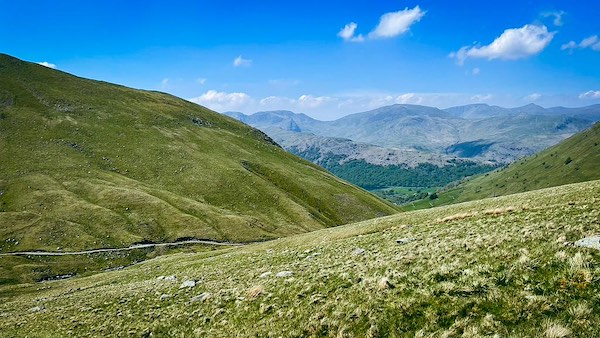
North East Face of Gray Crag and Path to Hayeswater
Gray Crag, Hartsop, Coast to Coast
Gray Crag is a classic whaleback fell, its smooth, elongated form closely mirroring that of nearby High Street. Rising to 699 metres, it sends a broad ridge southwards to Thornthwaite Beacon, where it merges seamlessly with the main High Street plateau — a natural continuation rather than a distinct summit break.
The fell is sharply defined by its flanks. To the east, Gray Crag drops steeply into the enclosed basin of Hayeswater, its rocky walls looming above the tarn and its feeder streams. To the west, the ground falls away more gently into Pasture Bottom, opening views toward the Dovedale and Kirkstone landscape. From Hartsop village, the approach along Hayeswater Beck offers one of the most revealing perspectives: the path passes beneath the pyramidal northern faces of both Hartsop Dodd and Gray Crag, before reaching Hayeswater itself and climbing onward via The Knott to High Street.
For Coast to Coast walkers, Gray Crag is less a destination than a dominant presence, shaping the eastern skyline of the Hartsop valley and forming part of the quiet, high ground that defines this stage of the route.
Gray Crag above Pasture Bottom
From the Hartsop to Hayeswater path, the west wall of Gray Crag rises sharply above Pasture Bottom, its whaleback form revealing itself in a sudden gain of height. The craggy upper slopes lift swiftly to the cairned summit at 698 m, while the true highest point of Gray Crag lies a little further south at 699 m. Beyond this, nearer to Thornthwaite Beacon, a higher knoll reaches 710 m, though it is not recognised as part of Gray Crag’s official summit.
North Face of Gray Crag
The north face of Gray Crag drops away in a series of rocky ribs and grassed shelves, with the ridge path descending gently down its tip between broken crags. From this angle the fell shows a more complex profile than its whaleback form suggests, with rough ground giving way to smoother turf lower down. Behind the ridge, the rounded summit of Hartsop Dodd peeks into view, while at the foot of the face Hayeswater Gill threads its way through the valley floor, accompanied by the well-used path linking Hartsop with Hayeswater.
East Face of Gray Crag
The east face of Gray Crag falls steeply toward Hayeswater, where a broad scatter of glacial moraines spreads across the shoreline. These mounded ridges of stone and debris encircle much of the lake and are remnants of a former corrie glacier that once filled the basin. As the ice retreated, it left behind this chaotic terrain, giving the lakeside its distinctive hummocky character and offering a clear lesson in the glacial origins of Hayeswater and the surrounding High Street fells.
South East Face of Gray Crag
Viewed from the High Street ridge, Gray Crag dominates the eastern side of the Hayeswater valley. Hayeswater Gill can be traced from the lake far up the valley head, almost to the rim of the plateau. Across the valley floor and lower slopes lie innumerable moraine deposits, extending well beyond the present shoreline and illustrating the former scale of the corrie glacier that once filled this basin.
Gray Crag Hayeswater
Seen from the Hartsop to Hayeswater path as it passes Pasture Bottom, the west wall of Gray Crag rises abruptly from the valley floor. The steepening profile of the fell gives a clear sense of its whaleback form, with rockier ground concentrated near the summit. The summit cairn stands at 698 m, while the true highest point lies a short distance south at 699 m. Beyond this, the ridge continues towards Thornthwaite Beacon, where a higher but unclassified top reaches 710 m.
True Summit of Gray Crag
Seen from High Street, the ridge of Gray Crag reveals its true summit part way along the crest, slightly south of the main cairn. Below the ridge, broken crags fall away steeply toward Hayeswater, particularly near the northern access point to the ridge. The long, gently curving whaleback profile links Gray Crag seamlessly with Thornthwaite Beacon and the wider High Street range.
Take the Coast to Coast Guide With You
Available on Apple Books — £12.99
Hiking the Coast to Coast combines step-by-step route directions, interactive mapping, hundreds of original photographs and information about the landscapes, history and places encountered along the route.
© 2026 Roy McKee · Coast to Coast
Contact - Privacy. - Terms


