Pen Howe, Sleights Moor, Coast to Coast
More Articles in the Grosmont to Robin Hood's Bay subsection
Pen Howe, Slieghts Moor, a Bronze Age Round Barrow
Pen Howe, Sleights Moor, Coast to Coast
Pen Howe is a Bronze Age Round Barrow sitting at the junction of the A169 dual carriageway on Sleights Moor, adjacent to Fairhead Lane as it crosses the Moor from Grosmont, to attain the dual carriageway. Pen Howe is 1.25 K south east of the High Bridestones, 4k east of Grosmont and 1 mile south of Sleights. The two Flat Howes are 1k north of Pen Howe.
A second Round Barrow is about 30m north of Pen Howe but only about half the size. A glance at the OS map will show that these barrows, the Flat Howe Barrows, Breckon Howe and another 10 form a row that projects south east, across the main road and down to Low Woof Howe in the NYM Forest Park, no doubt following a ley line.
Pen Howe Close Up
Pen Howe is listed with Historic England as a Scheduled Monument. A smaller Round Barrow is shown a little south east of this Barrow, and closeer to the A169, although due to its smaller size and height it is not readily visible unless looking for it.
Pen Howe Sleights Moor
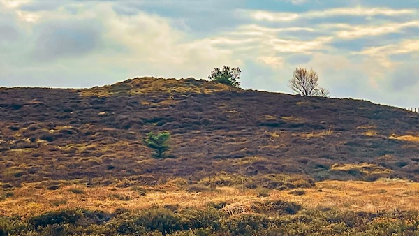
Pen Howe can hardly be missed from even a casual observer, being located at the side of the A169 dual carriageway on a prominent junction. It rises about 1.4 high above the moorland and is located close to the 297m summit of Sleights Moor, making it a very dominent and observable feature.
Pen Howe from further away
Even from a distance Pen Howe is quite noticeable. On the opposite side of the main road is Pen Howe Slack, a marshy area at the foot of Parsley Beck Rigg. To the south, about 1/2 k away is Breckon Howe, another Bronze Age Round Barrow.
Coast to Coast Trail Guide
Hiking the Coast to Coast
"Hiking the Coast to Coast" is a digitally enhanced eBook available from Apple Books for all people who have either a Mac, an iPhone or an iPad, and is designed to accompany you on your walk of the Coast to Coast path. The trail guide contains Ordnance Survey maps and other advanced mapping features, step by step directions, hundreds of colour photographs, details of the route, its conditions in different weather and research snippets relating to places of interest along the way.
