Raven Crag, Nannycatch - Coast to Coast
More Articles in the St Bees to Ennerdale Bridge subsection
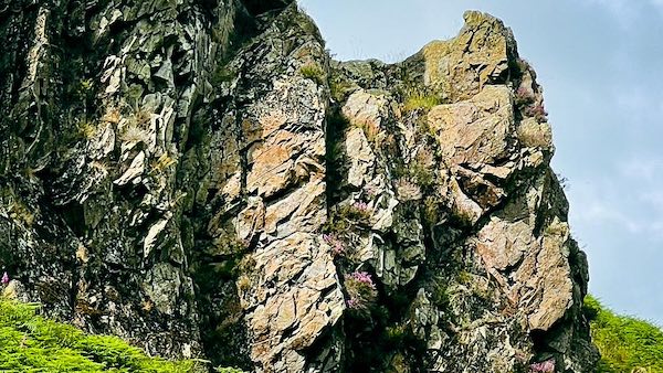
Close up of the Horn of Raven Crag
Raven Crag, Nannycatch Gate - Coast to Coast
Raven Crag is a prominent, rounded rock outcrop on the eastern shoulder of Dent Fell, looming above Nannycatch Gate. It’s a striking feature for walkers on the Coast to Coast route, easily visible as the trail descends steeply from Dent’s summit to the south side of the crag, eventually reaching the valley floor near Kirk Beck.
This rugged escarpment marks the northeastern corner of Dent Fell. To its north, Nannycatch Road winds northwest toward Cleator Moor, separating Dent Fell from Flat Fell. As the road nears the village, it crosses Wath Bridge — an old crossing over the River Ehen.
Raven Crag from Flat Fell
The south-eastern shoulder of Dent Fell rises to a minor summit at 283 m, crowned by the rugged outcrop of Raven Crag. Its steep southern and eastern faces expose Ordovician volcanic rocks, formed around 450 million years ago, creating one of the most distinctive landmarks overlooking Nannycatch Gate.
Raven Crag Nannycatch Gate
Viewed from the valley floor, Raven Crag dominates the skyline at the eastern shoulder of Dent Fell. Together with the opposing crags of Flat Fell, these rugged outcrops appear to stand as silent guardians of Nannycatch Gate, framing the narrow entrance to the valley that has guided travellers for centuries
Raven Crag from Kirk Beck
The Coast to Coast path descends the western slopes of Dent Fell, opposite Linkrigg Gill, to meet Kirk Beck beside Lowther Park Plantation. A short distance upstream, Raven Crag rises prominently above the valley, its rugged silhouette marking the eastern edge of Dent Fell and the entrance to Nannycatch Gate.
Raven Crag from Flat Fell Summit
From the southern shoulder of Flat Fell, Raven Crag rises beyond the narrowing entrance to Nannycatch Valley, where the opposing fells create a natural gateway through the landscape. Below, a well-defined footpath descends towards Standing Stones Farm and Near Thwaites, where it joins the Coast to Coast route beneath the rugged eastern flank of Dent Fell.
Take the Coast to Coast Guide With You
Available on Apple Books — £12.99
Hiking the Coast to Coast combines step-by-step route directions, interactive mapping, hundreds of original photographs and information about the landscapes, history and places encountered along the route.
© 2026 Roy McKee · Coast to Coast
Contact - Privacy. - Terms


