Greenup Edge, Coast to Coast
Know the Area Articles
Greenup Edge, Grasmere Common, Coast to Coast
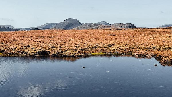
Pond close to High Raise on Greenup Edge
The height of the ridge allows spectacular views over the Central Lakeland Fells and unobstructed views to more distant Lakeland peaks.
High Raise and Low White Stones
Greenup Edge Langdale
From where the Coast to Coast path makes its way over Greenup Edge, looking south west will provide a view to Low White Stones, and, higher up, to High Raise, which is the summit of Greenup Edge.
High Raise Langdale
High Raise, or High White Stones as it is also known, is a 762m Wainwright, and the highest summit of the Central Lakeland Fells. As it is also centrally placed, its height and position provide the ideal viewpoint to observe the neighbouring mountainscape. In the middle distance is Glaramara, with Great Gable beyond.
Langstrath
From High Raise the Langstrath Valley dominates the western horizon, with an awesome view over the west face of Stonethwaite Fell. Quite striking on the fell are Black Wall and South Crag, High Buzzard Knott and Pinnacle Bield. The Ribby Gills can easily be discerned between South Crag and High Buzzard Knott. Stake and Lining Crag face them.
Low White Stones
Low White Stones, summiting at 730m is where the northbound direction of Greenup Edge begins to descend in earnest before climbing back to Ullscarf. To the north west of Low White Stones is Long Crag, topping the back wall of the Greenup basin.
Sergeant's Crag
From Low White Stones, a clear and uninterrupted view to Sergeant's Crag is maintained. Although only that part of the Crag visible from above can be seen it is sufficient to gauge its size and mass. The Crag lays on the rim of the fell that rises from Langstrath and is at an altitude of 571m. Sergeant's Crag is listed as a Wainwright.
Eagle Crag Skiddaw
From Low White Stones, a view downwards to the north highlights the summit of Eagle Crag at the end of the fell's finger. There is also a sensational view across the Stonethwaite Valley, Long Band and the declining slopes of Ullscarf, to Skiddaw, prominent by its height. Skiddaw is a 931m Wainwright. Keswick is seen at the foot of the Skiddaw range, and Bassenthwaite Lake to the west.
Coast to Coast Greenup Edge
The Coast to Coast path crosses over Greenup Edge after leaving the Greenup basin via Lining Crag. The path across Greenup Edge is well made and identified by a number of small cairns, until reaching the pass between Birks and the Flour Gill.
Ullscarf and Wythburn Valley
Looking north from Low White Stones imparts a dramatic view to Ullscarf falling away to the Wythburn Valley. Ullscarf is the second highest of the Greenup ridge summits, at 726m. High Raise is the highest at 762m and Thunacar Knott the 3rd, at 723m.
Coast to Coast Trail Guide
Hiking the Coast to Coast
"Hiking the Coast to Coast" is a digitally enhanced eBook available from Apple Books for all people who have either a Mac, an iPhone or an iPad, and is designed to accompany you on your walk of the Coast to Coast path. The trail guide contains Ordnance Survey maps and other advanced mapping features, step by step directions, hundreds of colour photographs, details of the route, its conditions in different weather and research snippets relating to places of interest along the way.
