Sunbiggin Tarn and Cow Dub, Tarn Moor
Historical and Educational Articles
Sunbiggin Tarn
There is a wide variety of breeding birds populating the tarn, which include (but not limited to) teal, tufted duck, wigeon, little grebe, water rail, sedge warbler mallard, lapwing, redshank and snipe.
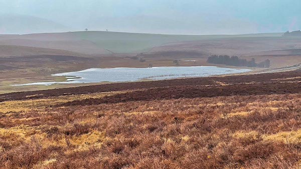
Sunbiggin Tarn from the top of Tarn Moor
Sunbiggin Tarn
Sunbiggin Tarn lies close to the moorland road that cuts across Ravenstonedale Moor from Raisbeck to Great Asby. The tarn is much larger than at first appears, as the reedy shores extend north and east, almost doubling the size of the tarn. A small water channel connects Sunbiggin Tarn to Cow Dub, a smaller tarn to its south.
Sunbiggin's Reedy Waters
It is evident from viewing Sunbiggin Tarn and its surrounds that it is drying up. The reeded shores of the lake are expanding. The same fate has befallen its neighbour Cow Dub, and Spears Pots, a more advanced dried up marl lake, about 200 meteres to the north.
Cow Dub
Cow Dub is a marl lake, positioned due south of Sunbiggin Tarn and connected by a narrow channel of water. As with Sunbiggin Tarn, Cow Dub is in the process of drying up. Reedy water around this tarn is at least double the tarn's size. The outflow from Cow dub is Tarn Sike which is subsumed by the Rais Beck near Slapestone Bridge, after re-springing near Holme House. Tarn Sike is a nature reserve managed by Cumbria Wildlife Trust.
Coast to Coast Trail Guide
Hiking the Coast to Coast
"Hiking the Coast to Coast" is a digitally enhanced eBook available from Apple Books for all people who have either a Mac, an iPhone or an iPad, and is designed to accompany you on your walk of the Coast to Coast path. The trail guide contains Ordnance Survey maps and other advanced mapping features, step by step directions, hundreds of colour photographs, details of the route, its conditions in different weather and research snippets relating to places of interest along the way.
